According to the National Hurricane Centre (NHC), Tropical Storm Ernesto is expected to bring tropical storm conditions to portions of the Leeward Islands late tonight and Tuesday and to the Virgin Islands and Puerto Rico by late Tuesday.
SITUATION OVERVIEW
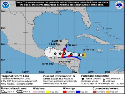
According to the National Hurricane Center (in Miami, Florida, At 200 PM EDT 1800 UTC), the center of Tropical Storm Lisa was located by satellite imagery near latitude 16 5 North, longitude 82.5 West Lisa is moving toward the west near 15 mph 24 km/h) This general motion with some decrease in forward speed is forecast during the next couple of days On the forecast track, the center of Lisa will move near or over the Bay Islands of Honduras early Wednesday, and move near Belize late on Wednesday.
Maximum sustained winds remain near 60 mph (95 km/h) with higher gusts Strengthening is expected, and Lisa is forecast to become a hurricane overnight over the northwestern Caribbean Sea and continue to intensify on Wednesday Tropical storm force winds extend outward up to 70 miles 110 km) from the center The estimated minimum central pressure is 1001 mb (29.56 inches).
Please click HERE for additional information.
SITUATION OVERVIEW
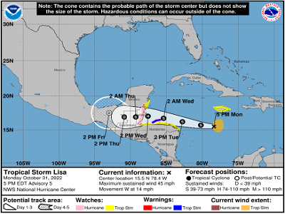
According to the National Hurricane Center ( in Miami, Florida, as of 5 00 PM,PM,( on October 31 2022 Tropical Storm Lisa is moving towards the west near 14 mph 22 km/h), and a westward to west northwestward motion is expected over the next few days On the forecast track, the center will pass south of Jamaica today, south of the Cayman Islands tomorrow, then move near or over the Bay Islands of Honduras early on Wednesday and approach Belize later on Wednesday Maximum sustained winds remain near 45 mph 75 km/h) with higher gusts Slow strengthening is forecast during the next 48 hours, and Lisa is forecast to become a hurricane on Wednesday over the northwestern Caribbean Sea Tropical storm force winds extend outward up to 105 miles (165 km) east of the center The estimated minimum central pressure is 1002 mb (29.59 inches).
Please click HERE for additional information.
SITUATION REPORT
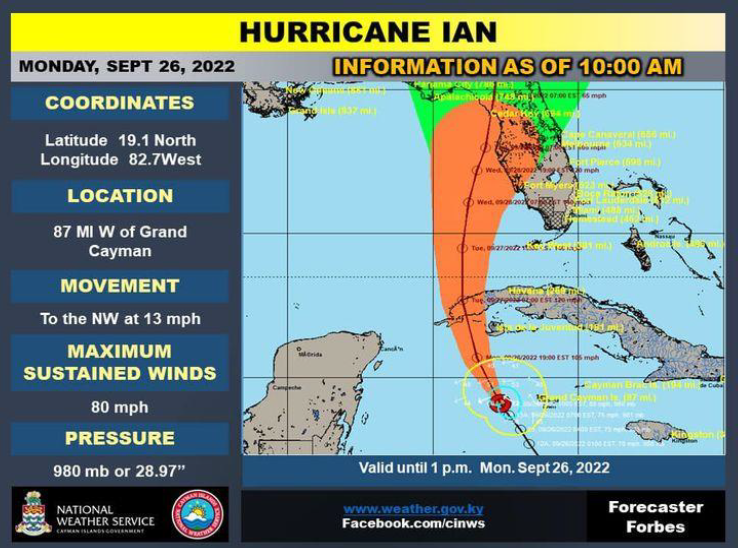
According to the Hazard Management Cayman Islands (HMCI), as of 10:00AM, Hurricane Ian was located at 19.1N and 82.7W of about 87miles W of Grand Cayman with maximum sustained winds of 80mph. Hurricane Ian is moving towards the NW at 13mph with minimum central pressure of 980mb/28.94 inches.
Please click HERE for additional information.
SITUATION OVERVIEW
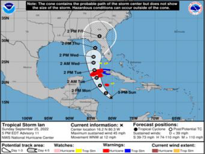
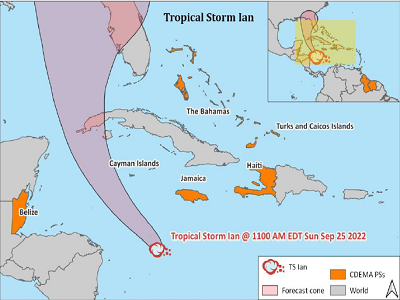
According to the National Hurricane Centre, at 500 PM EDT (2100 UTC), the center of Tropical Storm Ian was located near latitude 16.2 North, longitude 80.3 West. TS Ian is moving toward the west-northwest near 12 mph (19 km/h). A turn toward the northwest is expected tonight, followed by a north-northwestward motion on Monday and a northward motion on Tuesday with a slightly slower forward speed. On the forecast track, the center of TS Ian is expected to pass near or west of the Cayman Islands on Monday, and near or over western Cuba Monday night and early Tuesday.
TS Ian will then emerge over the southeastern Gulf of Mexico on Tuesday. Maximum sustained winds are near 45 mph (75 km/h) with higher gusts. Some strengthening is forecast tonight, followed by more rapid strengthening on Monday and Tuesday. Ian is forecast to become a hurricane on Monday and a major hurricane on Tuesday. Tropical-storm-force winds extend outward up to 35 miles (55 km) from the center. The estimated minimum central pressure is 1003 mb (29.62 inches).
Please click HERE for additional information.
SITUATION OVERVIEW
Please click HERE for additional information.
SITUATION OVERVIEW
The depression is expected to produce heavy rainfall, flash flooding and possible mudslides in areas of higher terrain in Aruba, Bonaire and Curacao. Heavy rains are also likely to spread into Jamaica, the Cayman Islands, and Cuba in the coming days.
A Tropical Storm Watch has been issued for Jamaica, with tropical storm conditions possible on the island by Sunday. A Hurricane Watch has been issued for the Cayman Islands, with hurricane conditions possible for early Monday and tropical storm conditions possible by late Sunday.
Please click HERE for additional information.
Update
The alert level for the La Soufrière volcano in St Vincent and the Grenadines has been elevated to Orange because of increased activity at the site Monitoring systems, satellite imagery and visual observations have confirmed increased seismic and fumarolic activity, strong gas emissions, emergence of a satellite dome on the SE of the existing volcanic dome and changes to the crater lake An effusive eruption within the crater, with visible gas and steam, was also observed on 29 th December 2020.
For full information note please click here.
National Hurricane Centre (NHC) Update
According to the National Hurricane Center ( in Miami, Florida, As of 1100 AM EDT 1500 UTC), the center of Hurricane Delta, now a category 3 Hurricane, was located near Latitude 18 2 North an d Longitude 82 6 West Delta is moving toward the west northwest near 16 mph 26 km/h) A west northwestward to northwestward motion is expected over the next couple of days A slower northwestward to north northwest motion is forecast to begin by late Wednesday or Wednesday night On the forecast track, the center of Delta is expected to continue to pass southwest of the Cayman Islands through early this afternoon, and move over the northeastern portion of the Yucatan peninsula late tonight or early Wednesday.